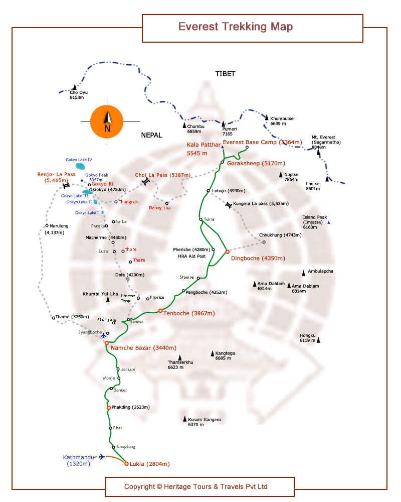
Transfer to airport, fly Kathmandu / Lukla and to Phakding (2640m) approx 3 hrs walk.
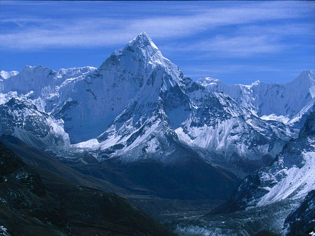
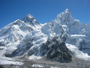
It takes approximately 45 minutes to fly from Kathmandu to Lukla, the trek starting point. First, pass through the cluster of lodges, bhattis (local bar), and souvenir shops at the end of the airstrip. From the edge of the village you will see the typical scenery of a mountain village with terraced fields and houses of piled stones. Down below to the left is Chaumrikharka village with farm fields and houses scattered in the fields. In the back of the village, the Dukh Kosi, which the Sherpas worship as the “sacred river,” runs deep in the V-shaped valley. You are going to climb along this river in order to go to Namche Bazaar. Mt Everest Base Camp is also situated at the head of this river.
The course will go down on the mountain flank. When it meets the old road from Chaumrikharka, Chapling will soon be reached. There are lodges here and there along the level path on the flank. Trek further down the flank, and you will come to Kusum Khola, the tributary. Far up the valley, you will see the soaring Kusum Kanguru West Peak (5,579 meters). After reaching the end of the ridge, you can easily trek down to Ghat, where there are three or four lodges. Go through the village and pass by a large mani stone, near which you will find a pass-like section. Cross over it, continue trekking on the flank, and you will notice that the Dudh Kosi below is getting closer to your left. You will soon reach Phakding(2,640 m) which has six or seven lodges. Overnight at guesthouse/lodge